


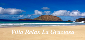


Maspalomas Cycling routes
1 – . Ayagaures We will leave the Constitution Square , crossing the Board address the Health Center , Aquasur and we will take the first turning on the right which leads to false flat but always upward continued to the foot of the dam in a distance Ayagaures 13 km climb to 320 m . Approximately 8 % gradient . There in the village take the turning to the left and through 1 km in flat terrain , takes us to the beginning of a 3 km climb that will leave us in his top at a lookout at a height of 480 m where very nice panoramic , for both Ayagaures Canyon , as the summit, and across Canyon Palmitos Park. From there through a flat – down , will get to Mountain Data ( high ) and continuously down a steep slope reach nearby Aquapark Health Center and Constitution Square , where we will have completed a lap of 25 km ( 15.53 mi) that is plain, plain rising , soaring , and fall flat again . As we see, very complete and really Maspalomas. . 2 – San Bartolomé de Tirajana ( TUNTE ) We leave Maspalomas direction of Neighborhoods on the C- 812 and through 20 km of flat pass by Neighborhood until junction Arinaga thence turning left we will take the road of The Corralillos to access up to the Age of Cardon to through the C- 815. To the left will continue to rise to a height of 500 m and from there by a false flat arrive to St. Lucia where we will access through 8 km in which we will continue rising to San Bartolome de Tirajana ( Tunte ) where we will be at 1000 m height . From there take the road C -520 heading toward Fataga always down quite hilly cross Fataga being careful and continue down to the palm Arteara where a rise begins in two parts , ie climbs for 1.5 km. We continue through a false flat and I attacked the last climb of the route in which we find two pretty tough sections but since we sighted the high vantage point and from there down for 8 km, we again Maspalomas completed by 80 km . 3.- PICO DE LAS NIEVES Taking as a point of departure the Constitution Square / City Hall 0 m high, we head to the Board at the first intersection and take the right direction to go in front of the Municipal Market , climb across Avenida del Castillo and Alejandro the junction with the road to the left Fataga take to begin the ascent to the first port of the day, the top of the Mirador de Fataga that reaches 400 m in about 800 m of ascent . Then comes a sharp decline and flat to the Palm of Arteara (200 m altitude ) where the climb begins to take us to Fataga , just before reaching the village and within it , find ramps 8 and 10 %. We continue climbing for 6 km to reach the Mirador de Tunte and San Bartolomé (1000 m). On leaving the village still heading Ayacata – Tejeda we find strong ramps for 9 km to Cruz Grande ( 1400 m) and there began a 6 km false flat that takes us to Ayacata . In the village (next to the church) there is a turn to the right towards Breasts . Just turning off the ramps are very hard, there is a 18% stretch for 6 km and so strong ramps with alternating sections more bearable . We arrived at the area known as Los Llanos de la Pez or Tables 6 km and from there over to the Pico de las Nieves and 2000 m high ceiling of the island approximately 50 km run of the 28 which are rising . The return can be made by the same route to Maspalomas. Recommended Developments: Plate 39 , 24/26 pinion . 4 – . CERCADOS OF HAWTHORN We leave the Plaza of the Constitution by the C -812 road to the left towards Mogan . Pass by Crossing Pasito Blanco. We will always follow through slides until km 10 , where we take the road to the right towards Fences Espino slowly rising to the village where we will be at 150m altitude. At the crossroads we find an 21.5 km section of the march. We take the direction of the left and the point 24 km and a height of 210 m pass by a group of houses called La Filipina . There begins the strong port through 6 km will lead to about 650 m high altitude and then, after a false flat, take us to the town of Soria and his prey with very nice views. This port we have uploaded is unique in that we are seeing as we go up the road climb for the panoramic viewpoints are constants. We will return by the same route , making the descent to Fences Espino, with caution because the slope is very steep . This march is about 70 km but very nice roads and little traffic .